October 24, 2022
by Catie Himes, Pacific Northwest National Laboratory
Hurricane damages cost an average of $20.5 billion per event in the United States. Their effects are widespread and often chronic, with loss of infrastructure, communities, and lives. The aftershocks ripple out farther still—pressure is mounting on the nation’s electricity grid as the frequency and intensity of hurricanes climb ever higher.
Scientists at the Department of Energy’s Pacific Northwest National Laboratory are working to better prepare authorities, emergency responders, and communities in the face of these increasingly extreme weather events. All while keeping our electricity flowing.
Worst-case scenario, but better
The front lines of hurricane response and recovery are riddled with overturned lives and costly damages, often over vast areas. While hurricanes themselves can’t be stopped, David Judi, leader of the Earth Systems Predictability and Resiliency group at PNNL, is spearheading solutions to better prepare for and counteract the worst effects of these extreme events.
Coordinating closely with the federal interagency system, which includes the Federal Emergency Management Agency (FEMA), Judi and his group use 7-day weather forecasts to drive flood models, such as the Rapid Infrastructure Flood Tool (RIFT), that estimate the areas that will be hardest hit. Coupling this with high-resolution topography data allows the team to account for local features, such as levies, that can significantly affect flooding and the distribution of damage in a hurricane’s path.
“Using this information, authorities can more effectively organize and strategically place resources, including emergency shelters, response personnel, and backup equipment for critical facilities like hospitals and nursing homes,” Judi said. They can also bolster and secure the electric grid to reduce long-term damage and minimize short-term power outages for customers.
Enduring the inevitable
The tools developed by Judi’s group aren’t just valuable in the lead-up to a storm. They also help communities by providing both situational awareness during an event and information to help them rapidly recover once the winds subside. Led by PNNL data scientist Andre Coleman, the group also uses a suite of tools known as Rapid Analytics for Disaster Response (RADR; one such tool, RADR-Fire, is used by PNNL researchers to combat wildfires) to detect on-the-ground flood extents and damaged infrastructure by harnessing satellite imagery. This helps energy managers and utility companies identify affected substations, for example. This is especially useful in cases of flooding, helping spot and triage inundated areas not accessible by foot in the early stages of recovery.
PNNL is taking on the heavyweights of the storm world—really any major event since 2016, including Harvey in 2017, Florence in 2018, and Ida just last year. The remnants of Ida, not to mention the storm itself, have become a case study in the effort to better understand climate change and its effects.
Most recently, Judi and his team put their capabilities to use helping communities during the historic Kentucky floods in late July of this year, the ongoing flooding and damages in Jackson, Mississippi, and Hurricanes Fiona and Ian. These events demonstrate the tools’ power in a variety of disaster scenarios.
How it works
With all the legwork of Judi and his colleagues, the system and its functions are now almost completely automated. Once an upcoming event is detected, the system immediately begins compiling data and forecasts from forecasting agencies, including the National Weather Service. The topography data for the entirety of the United States is already staged—all that’s left to do is tell it which area to focus on. The resulting estimates are relayed to federal, state, and local authorities, who utilize the information they provide to prepare as best they can for the onslaught ahead.
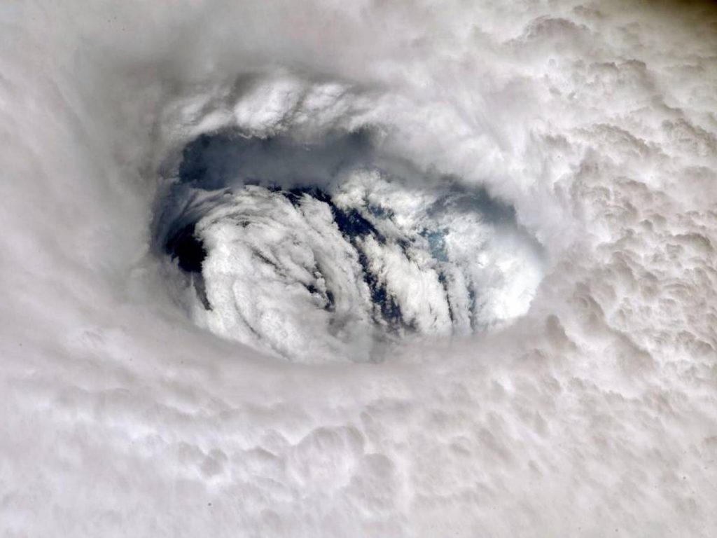
Both while the distinctive, swirling clouds of the hurricane are dealing blows and after they have finally withered, Coleman, Judi, and the rest of the team jump into action evaluating and detecting the damage. This includes using change detection imagery (a type of radar called synthetic-aperture radar, as well as altimetry data) to “see” through the thick clouds and detect flooding as it is happening, as well as assess specific areas by comparing aerial-view images of land both before and after the storm hits. The resulting data can have a resolution of less than 5 meters, providing detailed information about the worse-off areas and the full extent of the damage.
Although there are other models that take aim at hurricanes, PNNL leads the way in providing robust, predictive flooding context over large geographic areas in near real time. This is an invaluable capability important for communities both now and in the future.
Looking to the future
PNNL’s work doesn’t stop at the here-and-now. Researchers are working to better understand how hurricanes and their impacts might be affected by climate change. Ruby Leung, a PNNL atmospheric scientist and Battelle Fellow, is also the chief scientist of the Energy Exascale Earth System Model (better known as E3SM), an Earth system model developed to support DOE’s energy mission.
E3SM is specifically designed to run high-resolution climate simulations on DOE’s high-performance computers to better represent storms. Multiple DOE national laboratories have teamed up to model processes in the atmosphere, land, ocean, and ice, with PNNL scientists playing key roles in developing and using E3SM to answer new scientific questions. While Earth system models are typically run at coarse resolutions with limited ability to simulate storms, high-resolution E3SM simulations can provide far more accurate information about hurricanes, allowing more credible projections of their future changes.
E3SM targets the weather phenomenon known broadly as tropical cyclones, also called hurricanes or typhoons in different parts of the world. Major hurricanes are the strongest type of tropical cyclone, while tropical depressions are the weakest.
“E3SM is an important tool for modeling tropical cyclone intensity, frequency, and location of landfall,” Leung said. “By improving modeling of tropical cyclones, E3SM can provide critical information to address coastal vulnerability to climate change.”
A significant area of concern is learning how we can boost the resilience of the electric grid as hurricanes become more intense in a warmer climate. Without the grid, we run the risk of losing some of the key things that power our world as we know it—electricity, the internet, cell phones, and even running water. Current PNNL research is striking right at the nerve of this issue—Karthik Balaguru, a climate scientist and team lead for Coastal Modeling at PNNL who works closely with both Judi and Leung, is at the forefront of investigating how climate change will affect hurricane ferocity.
Balaguru and his colleagues recently found that the U.S. Atlantic Coast has become an especially potent area for creating wetter and faster-developing hurricanes. In a warmer world, they find hurricanes will only strengthen faster and bring new levels of flooding risk to the Atlantic coast, among other areas.
Shoring up the models
Hurricane research covers two primary aspects: understanding how a hurricane physically operates, and having a clear idea of what its impacts will look like. Scientists use a hierarchy of models to address this, with higher-resolution models allowing deeper analysis of a storm’s structure and its resulting behavior. However, even high-resolution models like E3SM are not enough to understand the full range of hurricane risk over longer time spans and over local-to-regional scales because of their significant computational cost. Enter the Risk Analysis Framework for Tropical Cyclones, or RAFT.
RAFT is a hybrid model that uses physics, statistics, and machine learning to simulate tropical cyclones that are expected to be produced by particular climates. The low computational cost of RAFT allows researchers to zoom in to specific locations and figure out the risks of various hurricane scenarios. Using environments from climate models, RAFT can simulate large numbers of storms and what kinds of effects they might have both in a given climate and with the evolution of climate change.
Balaguru is a key player in RAFT modeling. “RAFT allows risk to be projected into the future, vastly improving our understanding of how hurricanes will change alongside the climate,” Balaguru said. “This can also allow us to more deeply visualize possible threats to the grid.”
Bringing it all together
Both the real-time emergency scenario work of Judi and Coleman and the Earth system and tropical cyclone modeling research by Leung and Balaguru can be coupled for even better projections of tropical cyclone impacts.
Not only does this give communities a valuable way to minimize damages and recover quicker, but also for us to prepare ourselves and our resources for the more aggressive storms of the future.
More information: Judi and Balaguru recently presented a webinar, “Resilience to Hurricanes and Floods,” as part of the Grid Resilience @ PNNL webinar series. View the recording here.
Provided by Pacific Northwest National Laboratory
More information: Judi and Balaguru recently presented a webinar, “Resilience to Hurricanes and Floods,” as part of the Grid Resilience @ PNNL webinar series. View the recording here.


