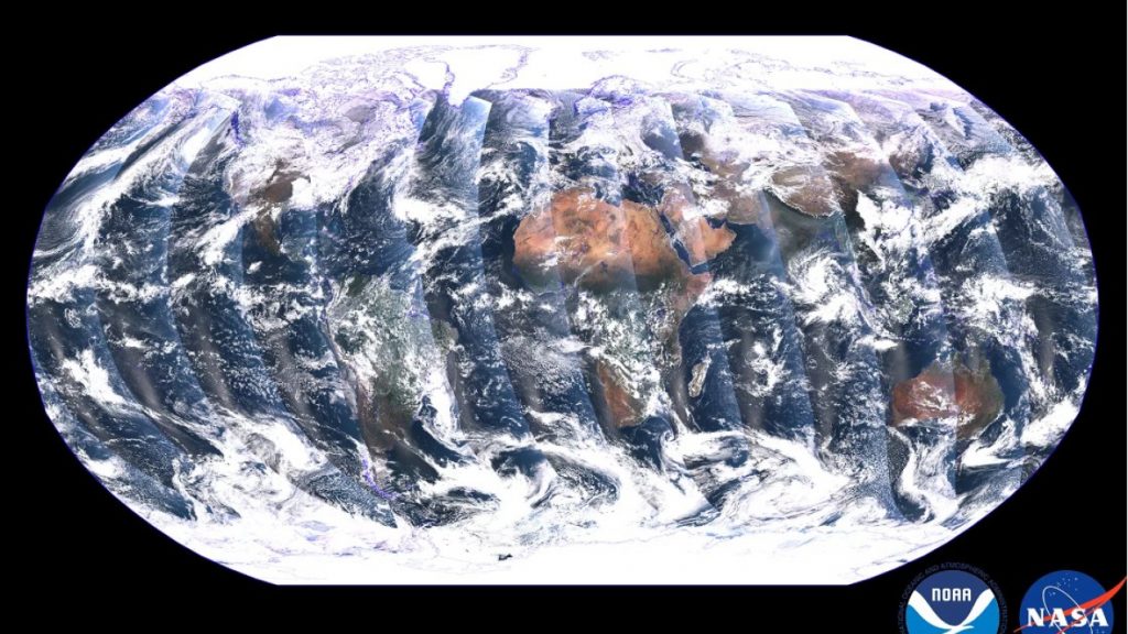
NOAA-21 satellite releases first imagery of Earth
Unlike geostationary satellites, polar-orbiting satellites capture swaths of data throughout the full globe, and observe the entire planet twice each day. This global mosaic, captured by the VIIRS instrument on the recently launched NOAA-21 satellite, is a composite image created from these swaths over a period of 24 hours between Dec. 5 and Dec. 6, 2022.
(NOAA STAR VIIRS SDR team)
(NOAA STAR VIIRS SDR team)
December 8, 2022
Satellites
Off


