


Editor’s Note: Today’s story is the answer to the May Puzzler.
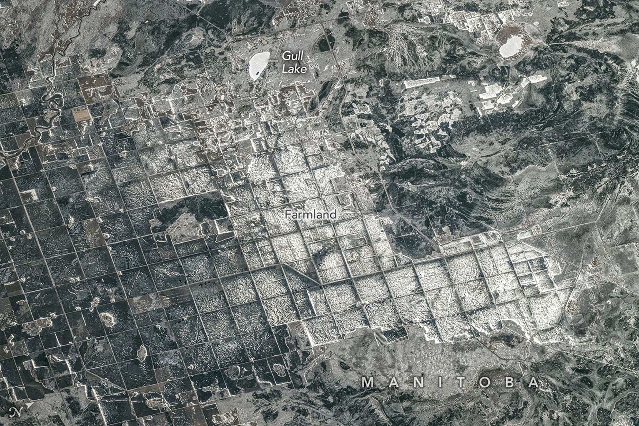
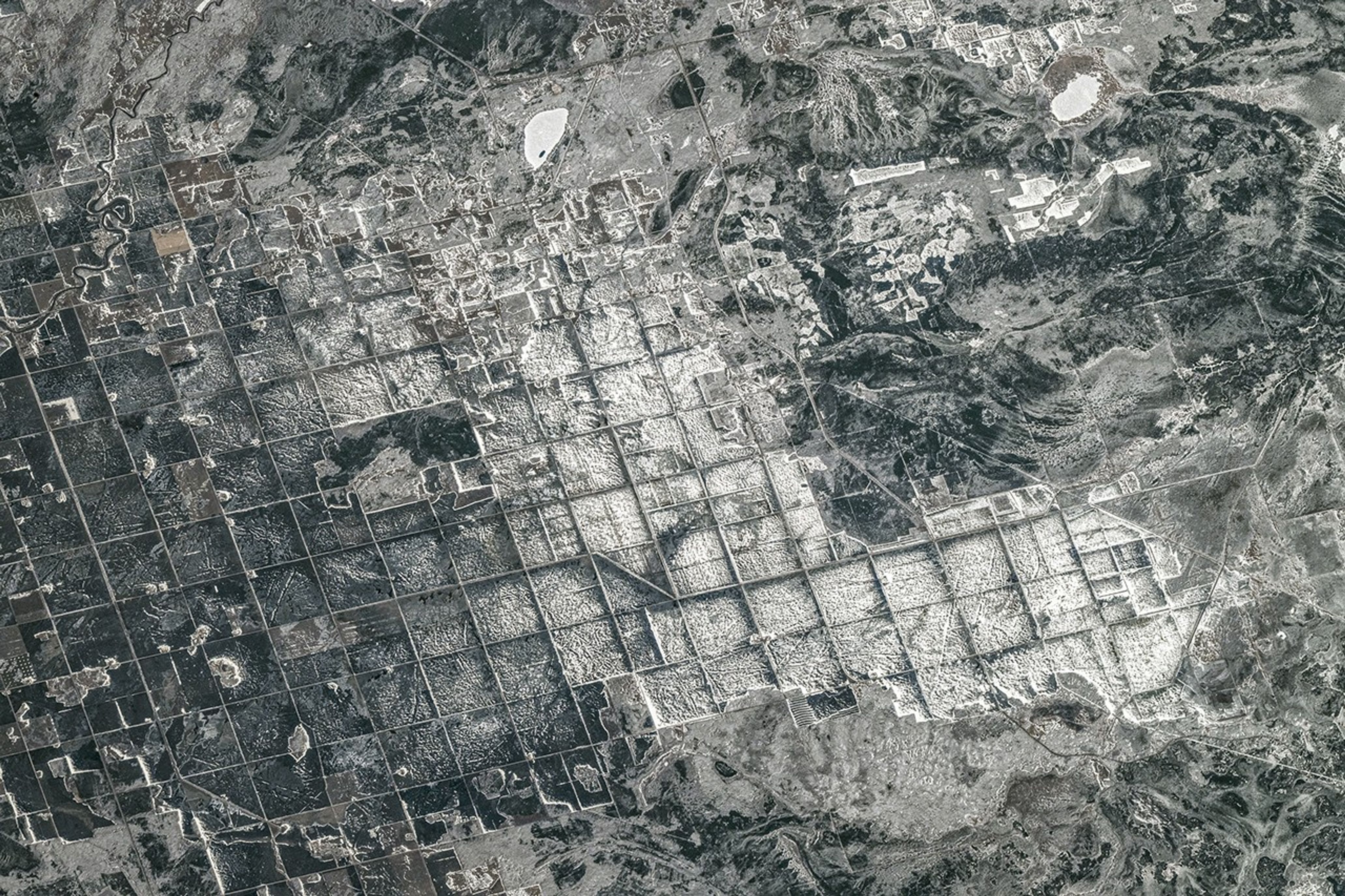
About 15,000 years ago, southeastern Manitoba sat beneath tens of meters of frigid water. Lake Agassiz—which once encompassed present-day Lake Manitoba, Lake Winnipeg, and Lake of the Woods—covered an area larger than all of the Great Lakes combined. It formed in front of the retreating Laurentide Ice Sheet, which dammed rivers that otherwise might have drained into Hudson Bay, producing an expansive body of water 1,100 kilometers (700 miles) long by 300 kilometers wide that spanned parts of today’s Manitoba, Ontario, Saskatchewan, North Dakota, and Minnesota.
The lake began draining roughly 12,000 years ago, but its legacy remains visible across the region. In April 2026, an astronaut aboard the International Space Station snapped this photograph of farmland along the southern shore of Lake Winnipeg, where Lake Agassiz once deposited a thick, nearly flat bed of nutrient-rich silt and clay. Former lakebed areas like this one now support some of Canada’s most productive agricultural landscapes.
A grid-based land survey has also left its mark. The Dominion Land Survey, one of the world’s largest and most systematic surveying efforts, divided much of western Canada into one-square-mile sections after the Canadian government purchased Rupert’s Land from the Hudson’s Bay Company in 1869. The grid continues to define the layout of farm fields, roads, shelterbelts, and drainage channels.
When the photo was taken late in the afternoon on April 19, a layer of snow and ice covered the landscape. The brightest, whitest blocks appear to be snow-covered farmland or icy ponds, while the darker areas are forests, wetlands, or exposed ground with less uniform snow cover.
Wheat, barley, oats, and canola are among the crops often grown in the area. In the upper part of the image, cottages and lake houses are clustered around Gull Lake, a popular site for boating, fishing, and other water sports. Common fish species found in the lake include northern pike, walleye, and yellow perch.
Astronaut photograph ISS074-E-494130 was acquired on April 19, 2026, with a Nikon Z9 digital camera using a focal length of 560 millimeters. It is provided by the ISS Crew Earth Observations Facility and the Earth Science and Remote Sensing Unit at NASA Johnson Space Center. The image was taken by a member of the Expedition 74 crew. The image has been cropped and enhanced to improve contrast, and lens artifacts have been removed. The International Space Station Program supports the laboratory as part of the ISS National Lab to help astronauts take pictures of Earth that will be of the greatest value to scientists and the public, and to make those images freely available on the Internet. Additional images taken by astronauts and cosmonauts can be viewed at the NASA/JSC Gateway to Astronaut Photography of Earth. Story by Adam Voiland.
References & Resources
- Alberta Geomatics Historical Society (2024, October 25) The Dominion Land Survey System. Accessed May 18, 2026.
- Beaches of 59, Gull Lake. Accessed May 18, 2026.
- The Canadian Encyclopedia (2025, February 21) Lake Agassiz. Accessed May 18, 2026.
- Manitoba Historical Society (1984) Review: James G. MacGregor, Vision of an Ordered Land: The Story of the Dominion Land Survey. Accessed May 18, 2026.
- Minnesota Historical Society (2025, January 29) Draining of Glacial Lake Agassiz. Accessed May 18, 2026.
- Manitoba Fish and Wildlife, Gull Lake. Accessed May 18, 2026.
- NASA Earth Observatory (2020, May 6) A Windbreak Grid in Hokkaido. Accessed May 18, 2026.
- NASA Johnson Space Center (2026, April 23) The sub-freezing landscape at the southern tip of Canada’s Lake Winnipeg. Accessed May 18, 2026.
- North Dakota Geological Survey, Glacial Lake Agassiz. Accessed May 18, 2026.
- State Historical Society of North Dakota, Red River Valley. Accessed May 18, 2026.
You may also be interested in:
Stay up-to-date with the latest content from NASA as we explore the universe and discover more about our home planet.

Lake Unter-See in Antarctica, sealed beneath thick ice, has unusual water chemistry and cone-shaped microbial structures resembling some of Earth’s…

Reed-covered mounds exposed by declining water levels reveal an unexpected network of freshwater springs that feed directly into the lake…

A blanket of snow spanned Michigan and much of the Great Lakes region following a potent cold snap.


The post Farming in Ancient Lake Agassiz appeared first on NASA Science.


